This article is part of our series on Delimitation of hydrographic sub-basins using QGIS and a DEM:
- Delimitation of hydrographic sub-basins using QGIS and a DEM
- Digital elevation models for hydrological studies
- Technical criteria for the delimitation of sub-basins (This post)
- Sub-basin delimitation process using QGIS
To delimit the hydrographic sub-basins of a country, it is necessary to establish a series of criteria that allow uniform results to be obtained throughout the study area.
Basic criteria
In this case, the following basic criteria were agreed with the Regional Water Administrations (ARAs):
- Sub-basins are not delimited in basins with an area of less than 3500 km2.
- Only the areas of the direct tributaries of the main river, which have a length equal to or greater than 55 km, are delimited as sub-basins.
- Only the areas of the direct tributaries of the main river that have an area equal to or greater than 300 km2are delimited as sub-basins.
Other criteria
In addition to the sub-basins resulting from the application of the basic criteria, the following areas were delimited for each river basin:
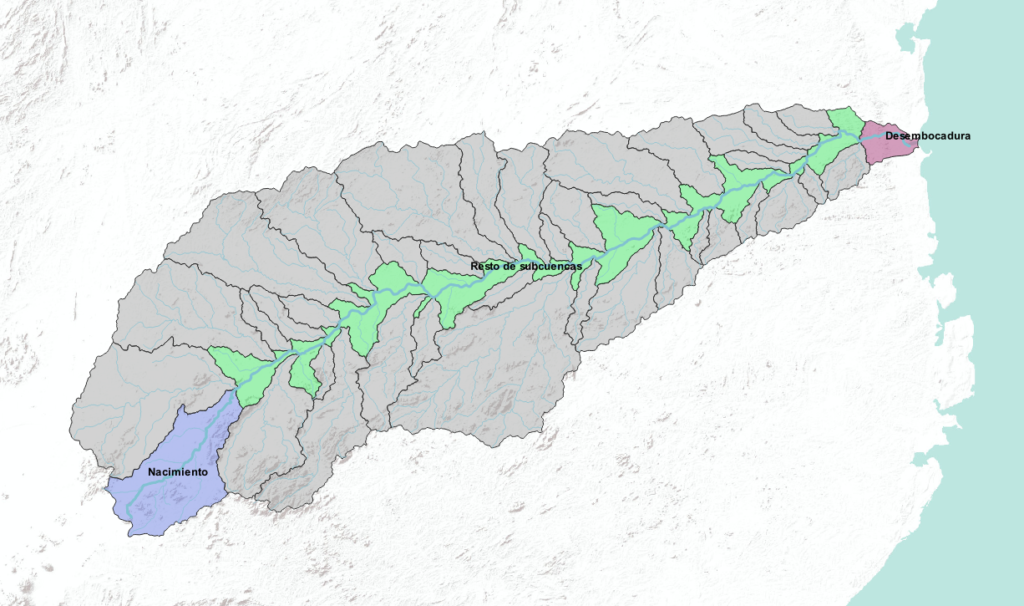
- Source area of the main river. In the case of transboundary rivers, that is, rivers that cross two or more states, the source may be outside the study area. In the case of Mozambique, there are several examples in which the source of the main river of the river basin is in another country (Zambezi, Limpopo, Incomati…). In these cases this area was not delimited.
- Area of the mouth of the main river.
- Area that includes the rest of the sub-basins, which do not meet the basic criteria, normally attached to the bed of the main river.
Exceptions
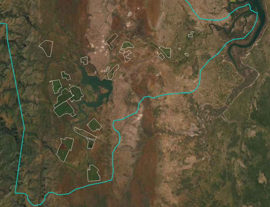
It was decided to delimit some sub-basins that did not meet the previous basic criteria and that we will call exceptions because they are sub-basins considered of great hydrological importance by the ARAs. An example of this is the delimitation of the sub-basins of the Umbelúzi River. Although the area of this basin is less than 3500 km2, it is of great hydrological importance because it contains a high percentage of large farms, with a very high demand for water.
In the next article, the last of the series, we will see how to do the whole process using QGIS.