Freshwater is essential for life and development. For this reason, it is of vital importance to carry out a correct planning, management and analysis of this natural resource. The national and regional administrations of water of each country carry out this work (hydrological plans, characterization studies, monitoring of the water balance…). And to achieve this, the study, delimitation and preservation of river basins is essential.
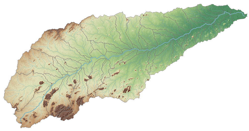
The EU Water Framework Directive defines a hydrographic basin as “the area of land from which all surface run-off flows through a sequence of streams, rivers and, possibly, lakes into the sea at a single river mouth, estuary or delta”. The river basin as a resource management unit is considered indivisible. Each basin in turn is divided into sub-basins, these being defined as the area of land from which all surface run-off flows through a series of streams, rivers and,possibly, lakes to a particular point in a water course (normally a lake or a river confluence).
Work context
At iCarto we have been working since 2012, first with the SIXHIARA project and later through the Blue Deal program, with the National Administration of Water Resources Management (DNGRH) and with the Regional Water Administrations (ARAs IP) of Mozambique. Among the actions, the creation of SIRH: Water Users and Licenses, the Water Resources Information System that is currently used by all the ARAs for the management of their licenses and water users, stands out.
This system used information from river and basin layers, created by the UDC’s Water and Environmental Engineering Group (GEAMA), but did not have a sub-basin layer. This type of information also did not exist in any of the national or regional administrations, being essential for proper planning and territorial management of water, especially in the country’s large basins. For all these reasons, the need to delimit the sub-basins of Mozambique was evident and the Dutch water authorities, through the Blue Deal program, decided to finance iCarto to carry out this activity.
The delimitation of sub-basins can be carried out through a hydrological analysis with a GIS application on a DEM (Digital Elevation Model). In our case we have used QGIS, a free open source GIS software, and the NASADEM global coverage model, since Mozambique does not have its own high-resolution model.
If you want to know more about the Digital Elevation Models and the process for the delimitation of sub-basins with QGIS in the following articles of this series you will find more information:
- Delimitation of hydrographic sub-basins using QGIS and a DEM (this post)
- Digital elevation models for hydrological studies
- Technical criteria for the delimitation of sub-basins
- Sub-basin delimitation process using QGIS