This article is part of our series on Delimitation of hydrographic sub-basins using QGIS and a DEM:
- Delimitation of hydrographic sub-basins using QGIS and a DEM
- Digital elevation models for hydrological studies (This post)
- Technical criteria for the delimitation of sub-basins
- Sub-basin delimitation process using QGIS
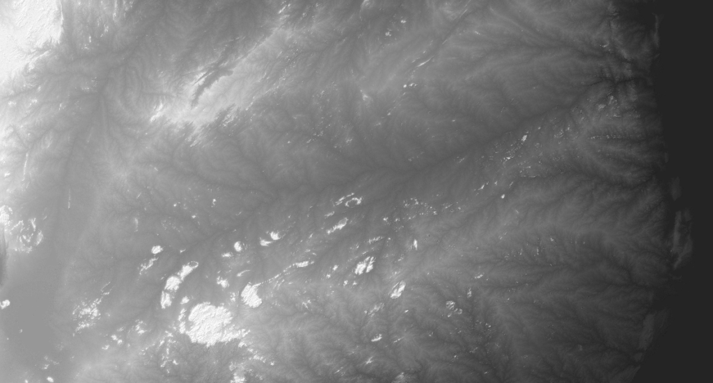
A digital elevation model (DEM) is a visual and mathematical representation that describes the altimetry of an area through a set of terrain elevations. The vegetation and infrastructures created by man (buildings, bridges, power lines, etc.) are not included, it only represents the relief of the ground.
DEMs are particularly useful in hydrological modeling (delimitation of basins, calculations of flow accumulations, flow directions), soil mapping and territorial planning.
There are currently quite a few sources that allow you to download DEMs with worldwide coverage for specific areas for free and without restrictions on use. The availability, updating and improvement of quality and precision of the DEMs represent a great contribution to the studies.
We do not analyze in this article other options subject to the payment of a license for their download and/or use.
Global DEM
Some of the most widely used global DEMs for hydrological analysis worldwide and freely available are the following:
- SRTMGL1 v003 (1 arc-second, 30 meters) and SRTMGL3 v003 (3 arc-secondar, 90 meters): The Shuttle Radar Topography Mission (SRTM) data sets are the result of collaboration between NASA and the National Geospatial-Intelligence Agency (NGA), with the participation of the German and Italian space agencies. The purpose of SRTM was to generate a digital elevation model. These MDEs are the best known and used globally. Version 3 is derived from the SRTM v2 data, but removes the gaps that were present in previous versions of the SRTM data. The gaps are filled by ASTER Global Digital Elevation Model (GDEM) Version 2.0, Global Multi-solution Terrain Elevation Data 2010 (GMTED2010), and National Elevation Dataset (NED). It offers resolutions of 1 and 3 seconds of arc, or what is the same resolutions between 30 and 90 meters.
- NASADEM HGT v001: (1 arc-second, 30 meters): The resolution of NASADEM is found in 1 degree of arc (just over 110 pixel kilometers) along the earth’s surface between 60º North and 56º South latitude, or what is the same as 30 meters of spatial resolution. This DEM is derived from SRTM data, fine-tuned with ASTER GDEM v2 data, incorporating GLAS ground control points, and developing additional backscatter and radiometric correction layers. Other enhancements include the use of GDEM and PRISM AW3D30 DEM, and gap fill interpolation.
- ASTER GDEM V3: ASTER GDEM Version 3 data products (1 arc-second, 30 meters) offer substantial improvements in coverage and reduction in the appearance of artifacts. It also provides improved spatial resolution and higher horizontal and vertical accuracy. Version 3 shows significant improvements over the previous version. However, it is cautioned that the data still contains anomalies and artifacts that will reduce its effectiveness for use in certain applications.
- ALOS PALSAR: This DEM is one of the resources available within the Japan Aerospace Exploration Agency (JAXA) ALOS satellite products. ALOS (Advanced Land Observation Satellite) also known as DAICHI, carries three sensors on board: the PRISM for panchromatic images, the PALSAR synthetic aperture radar and the AVNIR radiometer. It has higher spatial resolution than the SRTM and ASTER models, native resolution of 30 and 12.5 meters resampled.
Selection criteria
It does not exist a perfect model in order to delimitate all kind of river basins, but we need to select the onee that best suits our use case.
To carry out the delimitation of the sub-basins of Mozambique, the iCarto team decided to use NASADEM. The decision to select this model over others was based on several criteria:
- The starting layer of basins was made at the time from STRM data. The sub-basin layer had to be adjusted to this layer, so it was more appropriate to use a DEM also obtained from the Shuttle Radar Topographic Mission data.
- NASADEM is the most updated and corrected DEM of the models that come from STRM data.
- After reviewing different studies, it was concluded that for the delimitation of these sub-basins there would be no significant differences in the results obtained with any of the products with a resolution of 30 meters. Several studies have been published evaluating the vertical accuracy of these products. One of them is that of González-Morada and Viveen, who compared the ASTER GDEM, SRTM, AW3D30 and TanDEM-X DEMs with a set of 139 measurements collected by a dual-frequency Trimble 5800 GNSS receiver. The root mean square error (RMSE) was below 7 meters for all models.
- Some tests were carried out using various models and it was concluded that a resolution of 30 m was sufficient for this study. A higher resolution would imply excessively high processing times in exchange for an insignificant increase in precision for this analysis.
Where to download NASADEM products
NASADEM products can be downloaded from different platforms, two of the best known are:
- EARTHDATASEARCH (NASA’s browser)
- EARTHEXPLORER (USGS’s browser)
In both cases, the download is free, only prior registration is required.
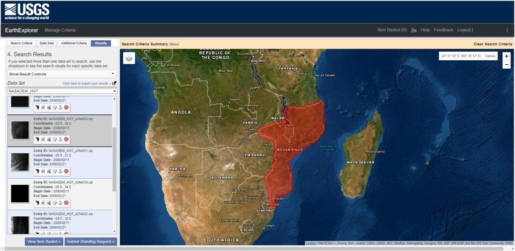
To download the NASADEM, for example, from the EarthExplorer search engine, it is only necessary to indicate the study area in the “Search Criteria” tab, search for and select “NASADEM_HGT” in the “Data Sets” tab, go to results and download all the files.
In the following articles of this series we will work on the DEM with QGIS and we will define the criteria for the delimitation of the sub-basins.