Preparation of a municipal street map, in GIS format, for the municipality of Ponteareas. Framed within the EDUSI project of the city council, the elaboration of this street map had two objectives: To have a municipal cartographic base in GIS format; Having a standardized street map (streets and portals) and geolocated, which serves as an information base for all municipal services. Having to start almost from scratch in terms of own information and not being able to generate it made us have to propose a low-cost street map, starting from geographic information from different public sources, combining and adapting them to obtain a complete base map and municipal street map.

Problems posed by the project
Among the objectives of the municipality of Ponteareas is the implementation of a Geographic Information System (GIS), as a transversal management tool. To achieve this, it is necessary to take steps, from the introduction of all the concepts related to geographic information management in the town hall, to obtaining a municipal cartography and geographic information for the different services, to implementing the appropriate technology that allows managing all the system.
In the specific point of information, the use of that with a geographical component was very unusual in the town hall, and the existing one was either outdated or in formats that did not allow it to be fully exploited. It was necessary to start generating information, in GIS format, standard and interoperable, that would allow having a standardized street plan, which included roads and portals, as a common base to feed all the services of the city hall. It was important that this street map be geolocated, to serve as a base when geographically locating different types of information, such as files, licenses, etc …

And how we solved them
The lack of information made us start practically from scratch, simply having some municipal information as support to consult and resolve possible doubtful cases. At the same time, generating an entire cartographic base of zero was not an option, due, among other factors, to the high cost that it would imply. The decision was to create a street map from different public mapping sources, combined with each other, choosing for each piece of data what seemed to us the best source and at the same time fitting well into the whole set. Thus, we review a lot of information from different organizations (IGN, Cadastre, Xunta de Galicia, Diputación de Pontevedra) that we adapt and combine to create a unique municipal street map.
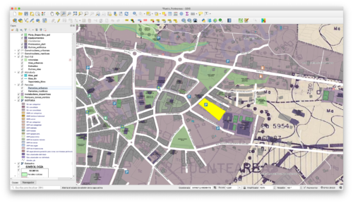
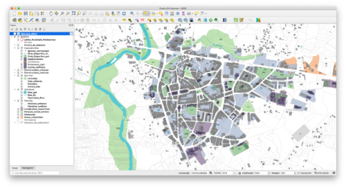
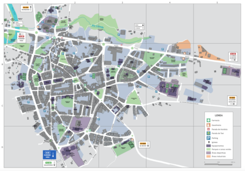
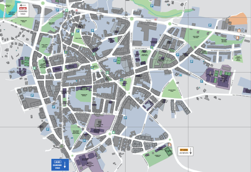
The layers related to the road and portal numbers required a more detailed review, comparing them with the information available in the town hall and having to do some editing work to adapt them to the current reality. With this work, a base map and municipal street map in GIS format was obtained, with all the layers including their metadata to, among other things, know the source and a detailed data model on the information they contain.
All the information was stylized and ordered through a QGIS project, for viewing and consultation. In addition, a template for printing municipal plans was included in this same QGIS project.